Newark Road and Baltimore Pike Intersection Improvements
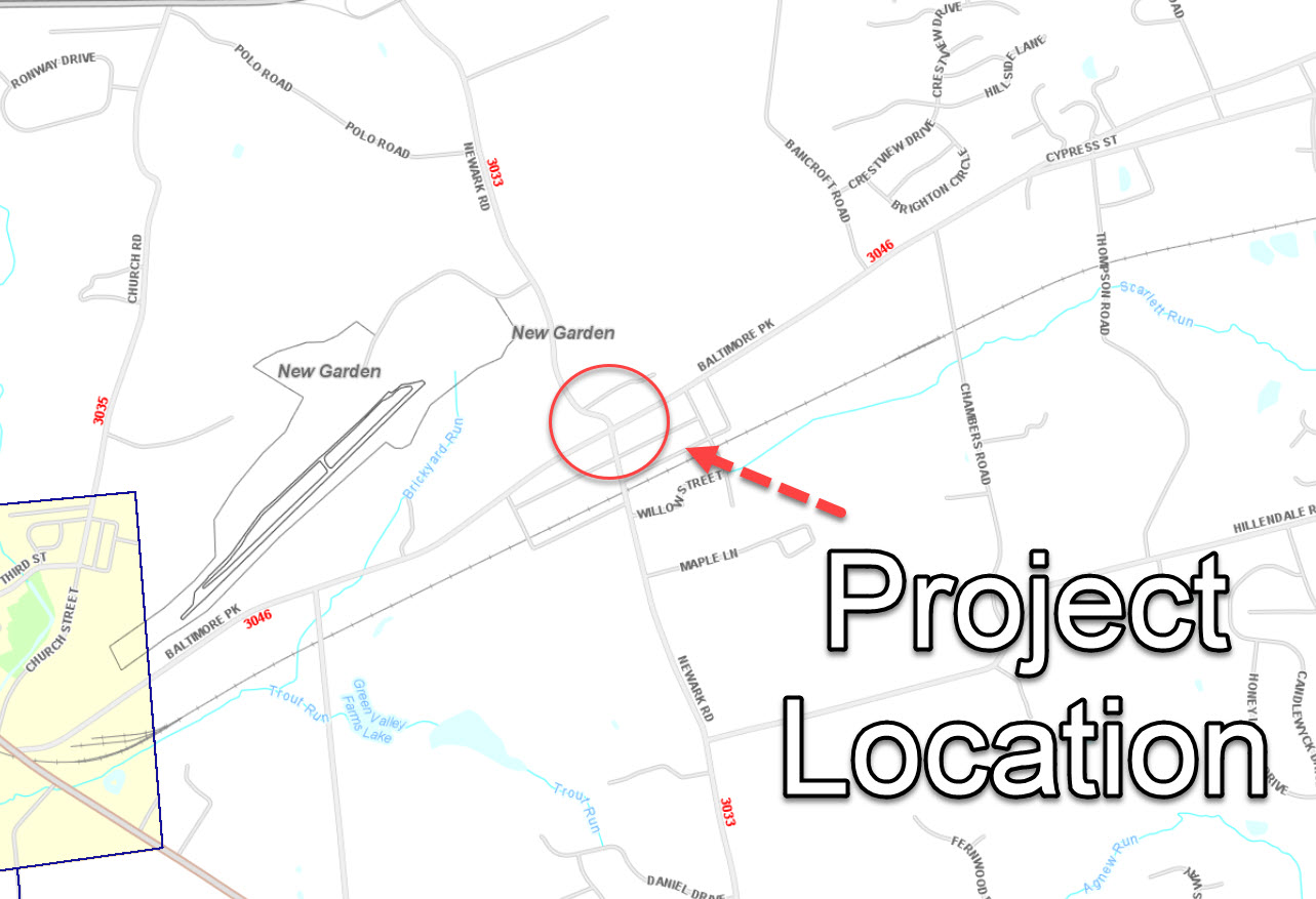
Project Location
Overview
The project is situated at the intersection of Newark Road and Baltimore Pike in New Garden Township, Chester County. The area immediately surrounding the intersection consists of a mix of commercial and residential land uses in the village of Toughkenamon. Other land uses near the project area are mushroom farms characteristic of New Garden Township and the New Garden Flying Field. The Kennett-Oxford Bypass (SR 0001) interchange with Newark Road is located approximately one mile to the north of the intersection. The Eastern Penn Railroad rail line is located approximately 700 feet south of the intersection.
The purpose of this project is to improve the existing alignment deficiencies of Newark Road and to improve intersection operation and safety for all users.
Currently, several geometric deficiencies at the intersection of Baltimore Pike and Newark Road contribute to congestion and safety issues. Existing northbound and southbound legs of Newark Road are offset from one another by +/- 30 feet at the intersection with Baltimore Pike, which causes safety hazards and contributes to poor operations at the intersection.
The southbound Newark Road approach to the intersection consists of a steep downgrade combined with a sharp reverse curve near the intersection. This presents a challenge to the numerous heavy vehicles traversing Newark Road from the local mushroom industry through the intersection. The current truck percentage is listed at 13 percent for the western leg of Baltimore Pike. Many land developments (including large warehousing expansions) planned in the area are expected to result in growth in traffic volumes in addition to normal regional background traffic growth. As a result, undue vehicular delay and queuing at this intersection are estimated to increase in the future.
Additionally, this intersection is in a mixed-use village that is served by public transportation. However, the intersection lacks adequate pedestrian accommodations to serve the needs of the community, which is worsened by poor access management along the Baltimore Pike. Additionally, the existing highway stormwater conveyance system that traverses through the village of Toughkenamon adjacent to the project is over capacity and is incapable of conveying existing highway stormwater runoff during medium and large storm events and will not be able to accommodate additional stormwater flows that would result for the project construction.
Proposed Improvements:
- Significantly realign the northern leg of Newark Road (S.R. 3033) to soften the reverse horizontal curve within the roadway and more appropriately align the approach with the southern leg of the roadway. Additionally, construction of the northern leg of Newark Road will include the addition of a 500-foot-long left-turn lane.
- Shift the intersection of Newark Road with Baltimore Pike (S.R. 3046) west to more directly align the northern and southern legs of Newark Road with one another. Provide turning radius improvements on all four corners of the intersection to better accommodate the heavy vehicles utilizing this intersection.
- Widen the southern leg of Newark Road to provide a 100-foot-long left-turn lane and a 150-foot-long right-turn lane.
- Widen the western leg of Baltimore Pike to provide a 225-foot-long left-turn lane.
- Widen the eastern leg of Baltimore Pike to provide a 175-foot-long left-turn lane and a separate 250-foot-long right-turn lane.
- Construct pedestrian facilities (curb ramps) at all corners of the intersection and sidewalks along the east, west, and south legs of the intersection.
- Install new traffic signal supports and equipment at the intersection.
- Install new pedestrian-scale streetlights within the limits of the project.
- Construct a new parallel stormwater conveyance system between the Baltimore Pike/Newark Road intersection and the existing stormwater conveyance system outfall to a UNT to the West Branch of Red Clay Creek (near Center Street and Willow Street), southeast of the project intersection.
- Construct stormwater management facilities to control stormwater runoff rate, and volume and promote downstream water quality.
- Utility poles within the limits of the project widening will need to be relocated due to the proposed roadway widening and realignment. Subsurface sewer, gas, and water lines will need to be relocated on the northern leg of Newark Road. Other subsurface relocations on the Baltimore Pike and the southern leg of Newark Road may be required to accommodate proposed roadway drainage structures.